
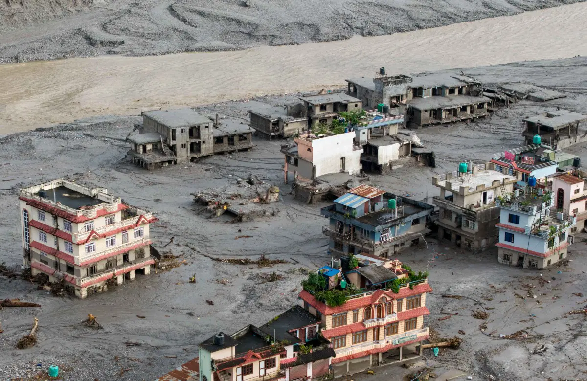
A massive glacier collapse in Nepal’s mountains near the Tibet border may have triggered the devastating floods and debris flows that killed at least 180 people in Nepal and Tibet.
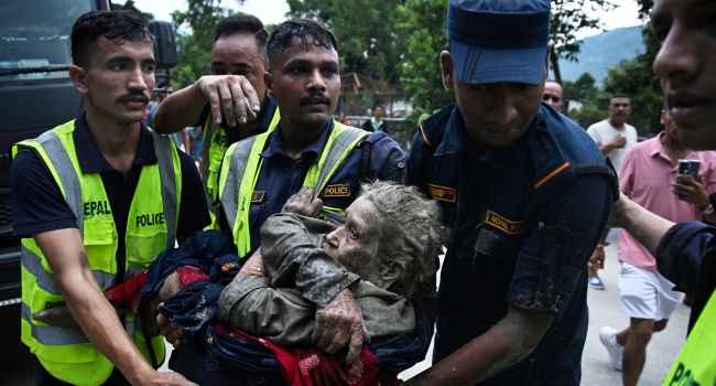
Experts say a huge section of ice fell thousands of metres from a glacier into a river valley, generating a powerful surge of water, rock, mud and debris that swept downstream through communities.
How the Disaster Began
Simon Cox, a principal scientist at New Zealand’s GNS Science, said a large section of glacier fell from about 5,200 metres into a valley.
“A large chunk of glacier fell from about 5,200 metres (about 17,000 feet)… into a valley,” Cox said.
The falling ice then transformed into a fast-moving mass of debris, gathering rocks, sediment, trees and other material as it moved through the canyon.
“It transformed into this raging mass of debris… where it picks up rocks and sediment and trees and anything in the way and fires it on down through the canyon,” he told AFP.
The surge first struck a border post, with CCTV footage showing mud and debris engulfing the area as people fled.
The flood then travelled downstream into Nepal, inundating villages and destroying bridges and buildings.
Collapse Mistaken for an Earthquake
The scale of the glacier collapse was large enough to register as a seismic event, initially leading authorities to believe an earthquake had occurred.
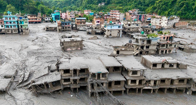
Further analysis by the US Geological Survey determined that the event was instead a glacial collapse and debris flow, with no earthquake taking place.
The collapse registered as a 5.2-magnitude seismic event at 8:37 am local time, or 0252 GMT.
Experts are still trying to determine how much ice collapsed. Cox estimated that the volume could range from about half a million cubic metres to tens of millions of cubic metres.
Scientists Reconstruct Disaster
With much of the affected area inaccessible, researchers are relying on satellite images and measurements from monitoring stations to establish what happened.
Lauren Vargo, a glaciologist at New Zealand’s Victoria University of Wellington, said researchers could compare satellite images taken before and after the event to identify changes in the landscape.
“We can look at satellite imagery taken before and after the event, and try and see what has changed, essentially looking for what is missing from the mountains in the ‘after’ imagery,” she said.
A nearby water monitoring station stopped transmitting shortly after the seismic activity was recorded, according to Nepali authorities.
Other stations downstream subsequently went offline. Authorities said water levels reached as high as 12.3 metres at Kalikhola, near the Tibet border, at 2:14 pm.
Was a Glacial Lake Involved?
Early speculation focused on a glacial lake outburst flood, or GLOF, a phenomenon that occurs when a natural barrier holding back a glacial lake suddenly collapses and releases a large volume of water.
Some experts initially believed a GLOF could have contributed to the disaster.
Adrian McCallum, a glaciologist at the University of the Sunshine Coast, said water can accumulate within and beneath glaciers.
“But to my mind, the only reason why a large volume of water should all of a sudden flow down a valley is because it has been released,” he told AFP.
However, other experts said they had not detected existing glacial lakes close to the site of the collapse.
One theory is that water accumulated beneath the glacier and was released as the ice fell. Another possibility is that the falling ice temporarily blocked the river, allowing water to build up before the obstruction gave way.
The impact was likely amplified by summer glacier melt and monsoon rains, which had already raised river levels. As the surge travelled downstream, it also accumulated enormous quantities of mud and debris, increasing its destructive force, Cox said.
Warnings Came as the Flood Advanced
Nepali authorities received reports of flooding at around 9:00 am local time and began warning communities along the Bhote Khoshi River to remain on high alert and move to safe areas.
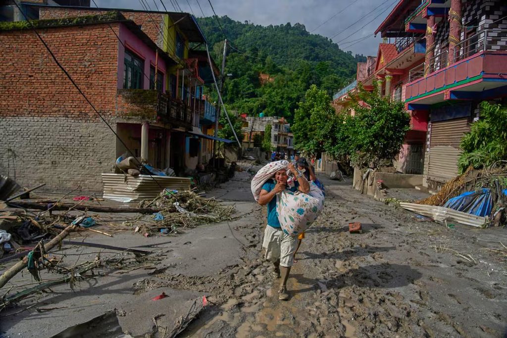
It remains unclear how many people received the warning or how much time residents had to escape.
McCallum described communities located beneath glaciers or glacial lakes as facing an inherent danger.
“The reality is, if you are in a community underneath a large glacier and potentially a glacier lake where a GLOF could occur, then to some extent, it’s a ticking time bomb,” he said.
For those who did receive warnings, however, escape options were limited.
Hydrologist Hatim Sharif of the University of Texas San Antonio said attempting to flee on foot or by vehicle would likely be ineffective against rapidly moving water and debris.
“Running will not help,” he told AFP, describing the mixture of mud and water as a lethal force “like liquid concrete.”
Sharif estimated that moving to higher ground at least 20 feet, or six metres, above the flood path could offer the best chance of survival.
Climate Change Adds to the Risk
Scientists caution that it is difficult to immediately link an individual glacier collapse to climate change, but global warming is increasing pressure on glaciers and changing mountain environments.
Glaciers are retreating around the world, creating new risks for communities downstream while also threatening important water supplies.
Lauren Vargo said reducing greenhouse gas emissions remains the most effective long-term way to limit the risks associated with a warming climate.
“The biggest way to mitigate the risk would be to reduce our greenhouse gas emissions to limit warming,” she said.
Author